作者:中华人民共和国水利部
页数:100
出版社:中国水利水电出版社
出版日期:2017
ISBN:9787517067740
电子书格式:pdf/epub/txt
内容简介
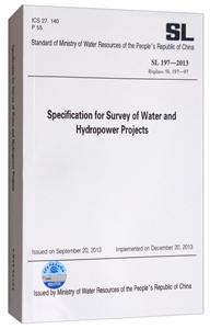
根据水利部水利行业标准制修订计划,按照《水利技术杯准编写规定》的要求,本标准共4章2个附录,主要技术内容有:——三、四、五等高程测量的方法与要求;一断面测量的方法与要求;——地形测量的方法与要求。根据水利部水利行业标准制修订计划,按照《水利技术杯准编写规定》的要求,本标准共4章2个附录,主要技术内容有:——三、四、五等高程测量的方法与要求;一断面测量的方法与要求;——地形测量的方法与要求。
作者简介
本标准由中华人民共和国水利部发布,起草单位为水利部黄河水利委员会水文局并由水利部黄河水利委员会水文局翻译。
本书特色
根据水利部水利行业标准制修订计划,按照《水利技术杯准编写规定》的要求,本标准共4章2个附录,主要技术内容有:——三、四、五等高程测量的方法与要求;一断面测量的方法与要求;——地形测量的方法与要求。根据水利部水利行业标准制修订计划,按照《水利技术杯准编写规定》的要求,本标准共4章2个附录,主要技术内容有:——三、四、五等高程测量的方法与要求;一断面测量的方法与要求;——地形测量的方法与要求。
目录
Introduction to English Version
Foreword
1 General Provisions
2 Vertical Survey
2.1 General Requirement
2.2 Basic Requirement of Leveling
2.3 Benchmark Setting
2.4 Level Observation
2.5 River-crossing Leveling
2.6 EDM Height Traversing
2.7 GNSS Leveling
2.8 Benchmark Leveling
2.9 Benchmark Check Leveling
2.10 Staff Gauge Zero Leveling
2.11 Vertical Survey of Flood Mark and Possible Maximum Cross-section Control Stake (Point)
3 Section Survey
3.1 Survey of Distance and Distance from Initial Point
3.2 Sounding Survey
3.3 Possible Maximum Cross-section Survey
3.4 Longitudinal Profile Survey
4 Topographic Survey
4.1 General Requirement
4.2 General Requirement of Horizontal Control Survey
4.3 Travcrse Survey
4.4 Triangulation
4.5 GNSS Horizontal Control Survey
4.6 Plotting and Densification of Control Points
4.7 Land Topographic Survey
4.8 Underwater Topographic Survey
4.9 Digital Mapping
4.10 Compilation of Topographic Map
Annex A Record Table and Filling Instructions of Staff Gauge Zero Leveling
Annex B Record Table of Section Survey
Explanation of Wording


